In April 2018 friends and I rafted 35 miles of the Illinois River (in southwestern Oregon, not Illinois), guided by Zach Collier of Northwest Resting Company. This Wild and Scenic River was named by the three Althouse brothers from Illinois who mined gold in this area. We encountered 149 Rapids between our launch at Oak Flat and our takeout near Agness (the confluence of the Illinois and Rogue rivers). Josephine County has a mean annual precipitation of 32 inches; we had beautiful spring weather.
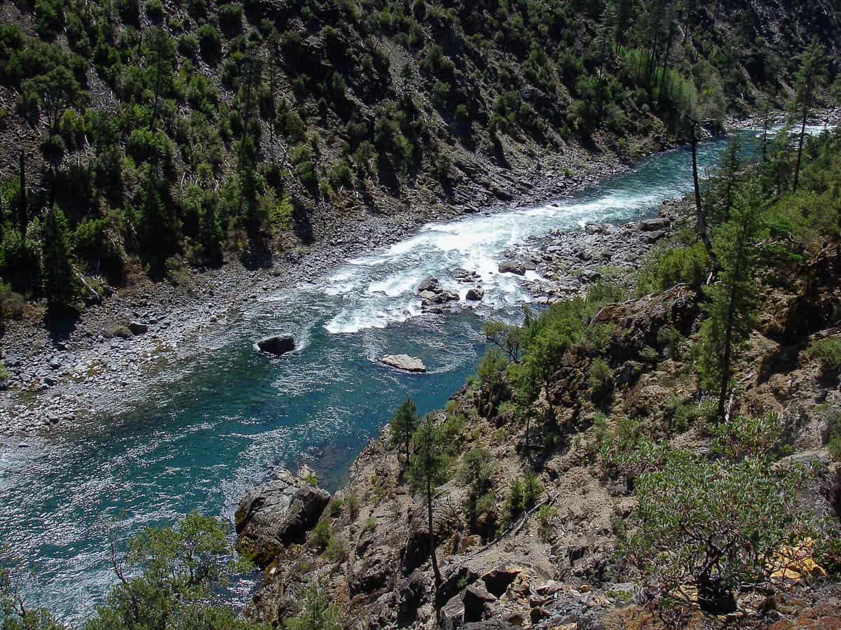
The area has a huge diversity of vegetation in part because three ecoregions meet in the Klamath Mountains: one which extends north to coastal Alaska, a second which stretches south to Baja California, and a third linked to the Cascades Range to the East. Also, variation in elevation, aspect [direction a slope faces], and lithology [rock type] add to the plant diversity.
Early history
“The first boating venture by white men down the Illinois River was made by three prospectors in August 1857. Their boat was built of hand-hewn Port Orford cedar and was launched at the mouth of Rancherie Creek, which joins the Illinois about 5 miles above Oak Flat. The account of this expedition (published in the Grants Pass Courier April 25, 1924 and in a special edition April 2, 1960) is told by Dan L. Green, first sheriff of Josephine County, who made the trip with Capt. O. T. Root and a sailor named Fisher. Green tells of their unsuccessful hunt for gold, various encounters with Indians, and the loss of supplies and equipment when their boat swamped in rapids. He mentioned seeing many deer, elk, and large, black timber wolves (Ramp, 1964, p. 98).”
Geology of the Klamath Mountains
The Klamath Mountains have extremely complex geology, with many different lithologies ranging in age from late Proterozoic (about 640 million years ago) through Oligocene (about 30 million years ago) as well as countless faults and other structures. Most of the rocks of the Klamath Mountains did not form in North America; fragments of continents, seafloor, and island arcs (like the Aleutians) originated far to the south and west. These fragments or terranes (fault-bounded rocks of regional extent, with a geologic history different from that of nearby rocks) were accreted to North America by plate tectonic processes. Specifically, different terranes were subducted and rotated from the Devonian (about 400 million years ago) to present.
The oldest terranes lie to the southeast, California; terranes are progressively younger toward the northwest. The oldest terrane in the Oregon portion of the Klamath Mountains, the Western Paleozoic and Triassic Belt, was accreted to North America in the middle late Jurassic (about 150 million years ago). As these fragments of exotic rocks joined North America, the heat caused metamorphism, as well as intrusion of igneous rocks, sometimes called stitching plutons; also, the terranes were rotated clockwise due to the relative motion of the North American and Pacific tectonic plates.
Geology of the lower Illinois River
The bedrock from Oak Flat to Pine Flat is igneous, not volcanic but plutonic because the magma cooled far beneath Earth’s surface, allowing large crystals to grow. These Mesozoic plutonic rocks were intruded into older rocks, and were not exposed at Earth’s surface until considerable uplift and erosion occurred.
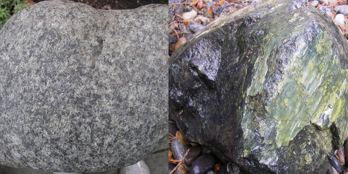
Near Oak Flat and Pine Flat is “granitic” rock (not granite itself), crystallized from silica-rich magma. Most of these crystals are feldspar (aluminum silicates with potassium, sodium, and/or calcium). The specific granitic rocks near Oak Flat and Pine Flat are: quartz diorite with quartz and plagioclase; granodiorite with quartz, plagioclase, and potassium feldspar; and hornblende diorite with plagioclase and hornblende. Hornblende is a black, often needle-shaped mineral with iron and magnesium.
Most of the river’s channel between these outcrops of granitic rock at Oak Flat and Pine Flat is cut into dark igneous rock which crystallized from silica-poor magma. The gabbro crystallized in an oceanic setting where seafloor was spreading; this seafloor was accreted to North America. Gabbro is dark because of an abundance of iron- and magnesium-rich minerals like olivine, pyroxene, and hornblende. The gabbro is older than the granitic rocks; parts have been metamorphosed to gneiss, here characterized by steeply-dipping bands of alternating light and dark minerals.
From Pine Flat to the Rogue River most of the bedrock is the Upper Jurassic (about 150 million years old) Dothan Formation. About a mile west of Pine Flat is a terrane boundary where a fault separates the younger Dothan Formation to the west from the older plutonic metagabbro is looking for the rocks to the east. This is a thrust fault where the younger rocks of one terrane were shoved beneath the older rocks of another terrane.
Immediately west of the terrane boundary the Dothan Formation is volcanic. Basaltic magma erupted at the seafloor forming pillows. Explosions resulted in volcanic ash, lithified into tuff.
However, most of the Dothan Formation began as sediments deposited in the ocean. Pebbles and cobbles became conglomerate. Silt and sand became siltstone and sandstone. Mixtures of silt and clay became mudstone. These sediments are called turbidites: sediment that accumulated underwater on steep slopes at the edge of the continent became unstable because of earthquakes, storms, and/or oversteepening. Density currents of water and sediment rushed down the continental slope and/or submarine canyons; these turbidity currents slowed on the ocean floor, with sediment being deposited in order of size: cobbles, pebbles, sand, silt, and clay. A single turbidite is coarsest at the bottom and finest at the top. As it is being deposited, one turbidite may scour the one beneath it, ripping up the mud. Because mud is cohesive, a chip of mud from the underlying turbidite may be incorporated into the overlying turbidite.
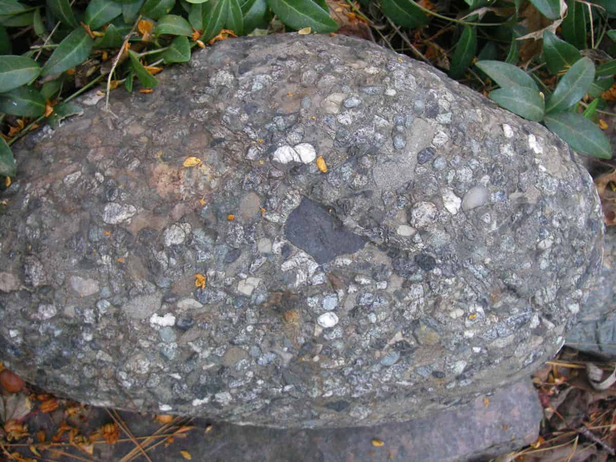
The dominant lithology in the sedimentary portion of the Dothan Formation is a particular sandstone called graywacke. Unlike quartz sandstone (its name indicates that most of the sand grains are quartz), graywacke has a high percentage of tiny rock fragments. These rock fragments are chemically and mechanically less resistant than quartz, indicating that the sediment was not very mature (did not have multiple episodes of weathering and abrasion).
Particularly interesting in the Dothan Formation is chert, microcrystalline and/or cryptocrystalline quartz. Siliceous skeletons of diatoms and radiolarians sank to the seafloor to become a fine-grained ooze, eventually lithified into chert. Because it is composed of quartz, which has a hardness of 7, chert was valuable to Native Americans for making tools, like arrowheads. Chert has a conchoidal fracture (as does thick glass); the edges can be very sharp. Chert can be almost any color, but here it is red, due to trace amounts of iron, perhaps derived from nearby basaltic eruptions.
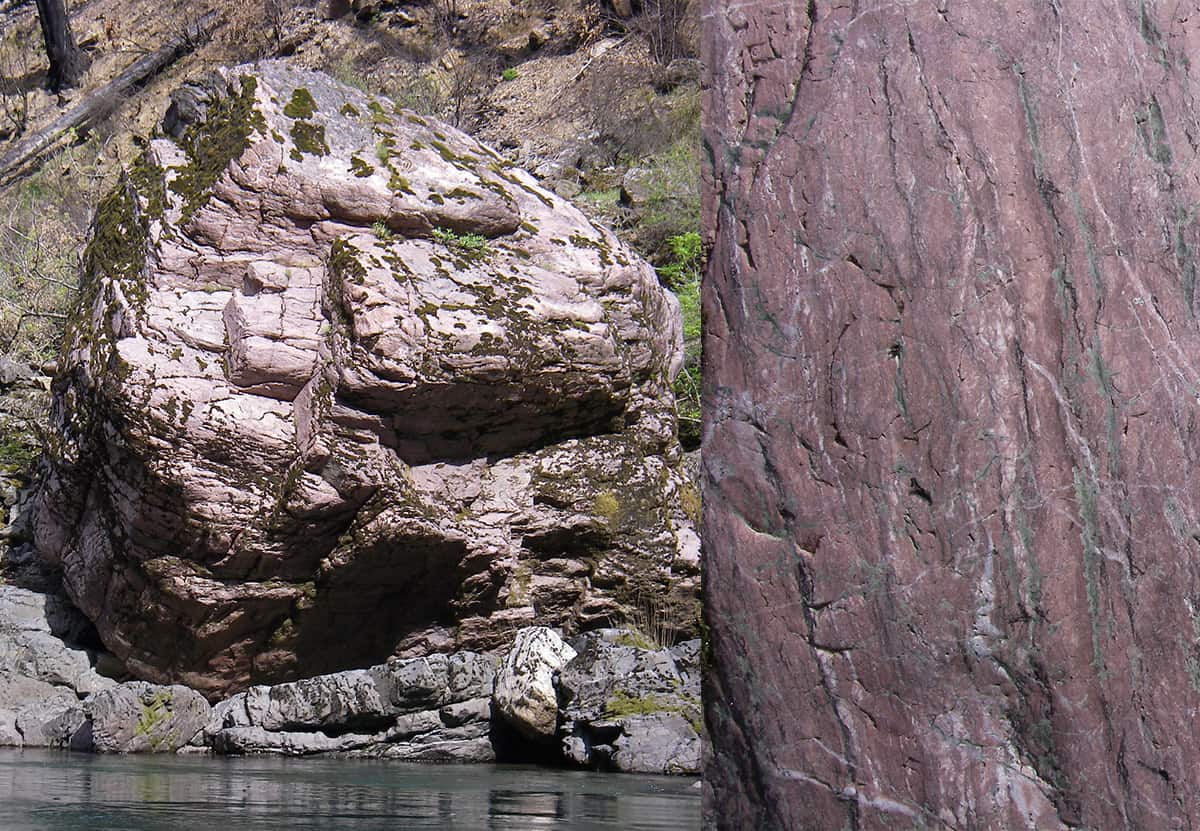
Once the Illinois River turns north along the Josephine County-Curry County border, the Dothan Formation is, for the most part, left behind. Instead most of the river channel is cut in metagabbro. Gabbro, the original dark plutonic rock, consisted of plagioclase and pyroxene or hornblende; it was metamorphosed as it got subducted when terranes collided.
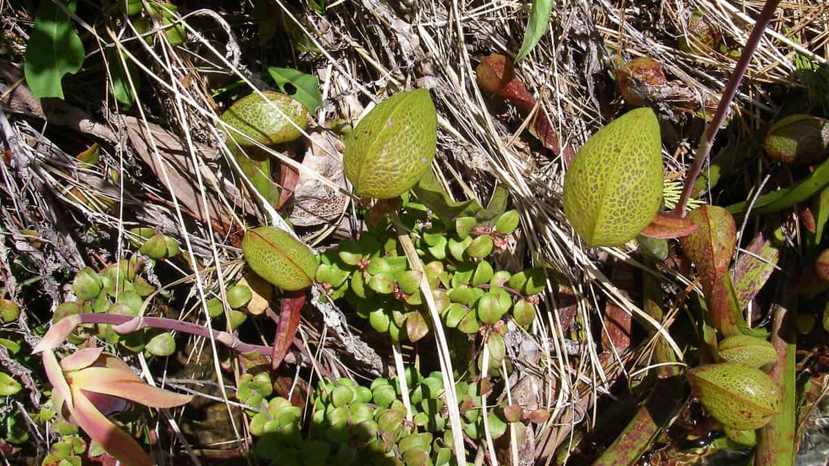
Some of the ultramafic rocks in the Klamath Mountains crop out along this lowest portion of the Illinois River. These ultramafic bodies crystallized in Earth’s upper mantle as peridotite, a rock with olivine and pyroxene. Much of the peridotite has been metamorphosed to serpentinite during injection into Earth’s crust. Soils developed on peridotite and serpentinite are poor in nutrients and have relatively high concentrations of toxic heavy metals like nickel and chromium. Most plants cannot survive on serpentine soils, so vegetation is not abundant except for some specialists like pitcher plants.
References
Orr, E. L., and W. N. Orr, 2012, Oregon geology: Corvallis, Oregon State University Press, p. 48-75.
Ramp, Len, 1964, Geologic adventures on the lower Illinois River, southwestern Oregon: The ORE BIN, v. 26, no. 6, p. 97-108.
Ramp, Len, and N. V. Peterson, 1979, Geology and mineral resources of Josephine County, Oregon: Oregon Department of Geology and Mineral Industries Bulletin 100, 45 p.
Ramp, Len, H. G. Schlicker, and J. J. Gray, 1977, Geology, mineral resources, and rock material of Curry County, Oregon: Oregon Department of Geology and Mineral Industries Bulletin 93, 79 p.
